GISPRO SA
GISPRO SA is a company that provides specialized services in the field of geomatics, photogrammetry and remote sensing, geodesy and cartography, investment services and IT. Our offer is focused on comprehensive services including the acquisition, processing and analysis of spatial data. It also includes the implementation of solutions and support in the management of geospatial information.
Our clients are entities from many sectors of the economy: public administration bodies, construction, industrial, transport, insurance industries, institutions related to environmental protection, agriculture and forest management.
Our knowledge, experience and potential give us the opportunity to support our clients in the implementation of their ambitious projects, as well as their daily own tasks. The wide range of services provided allows us to play the role of a key partner in the provision of geospatial data and significantly contribute to their success.
In order to meet the needs and expectations of today’s world, we develop our own new geospatial technologies and carry out research and development projects. We work on innovative solutions contributing to the creation of tomorrow’s technology.
“Look deep into nature,
and then you will understand
everything better.”
– Albert Einstein
Mission
Nowadays, the world is changing dynamically. Technological progress, climate change, environmental degradation all affect the reality that surrounds us. It forces us to take actions on scales never known before.
Pollution generated by the energy, industrial and transport sectors is driving the need to restructure economies by switching to renewable energy sources, modernizing industrial installations and reorganizing transport towards low-carbon measures.
Climate change has far-reaching environmental consequences. Monitoring of ecosystems is necessary to carry out remedial and supportive activities. It should help in deciding how to effectively protect them, so that they will serve the next generations.
Natural resources exploited economically as a result of agricultural activities and forest management should be optimally exploited, with the lowest possible impact on the natural environment. The key is to reduce chemical pesticides and the amount of fertilizers used. This can be achieved by implementing solutions based on targeted information and spatial analysis.
The overriding goal of GISPRO is to support processes and activities aimed at sustainable, neutral development. Their indispensable element is reliable and complete geospatial information about the surrounding environment. GISPRO’s main goal is to provide its clients with complete solutions, analyzes and tools supporting their functioning in an incredibly fast-changing world.
Strategy
The goals set before us determine our actions. We are aware of the importance of our role in design processes. Our products and services form the basis of: planning, designing, building and managing. The reliability and credibility of our studies is of key importance for the proper implementation of many economic tasks.
It is extremely important for us to increase the efficiency and accuracy of our studies, while at the same time reducing the negative effects of our activities on the natural environment. Responding to the constantly changing needs of our clients, we adapt our offer based on the latest technologies and scientific knowledge. We invest in innovative solutions for the acquisition, processing and analysis of spatial data. We carry out research and development projects in the field of developing technologies for analyzing environmental changes and modern measurement methods based on multisensory data fusion.
We carry out our tasks despite the difficulties encountered. Depending on the needs, we are present on land, in the air, on and under water and under the surface of the earth. We adapt tools and technologies to the needs of our clients. We undertake difficult tasks that require extensive interdisciplinary experience. Thanks to an extensive team of engineers with various specializations, we can meet them.
Our main goal is the development of the services we provide, in particular in such segments as: public administration, infrastructure, environment, agriculture and forest management. Our priority is to offer complete services and products that meet the expectations of our Clients.

History
GISPRO was founded in 2006 in Szczecin. We started our commercial activity with a team of five, who was one of the few in Poland responsible for the development of topographic databases for the digitization of cartographic studies. We participated in all stages of development and expansion of this project, implementing tasks from the TBD data standard to the currently operating BDOT10k.
In 2007 we extended the scope of our services to support infrastructure investments, contributing to the creation of a network of expressways and motorways in Poland. The first project of this type was the geodetic service of the construction of the S3 expressway Szczecin Klucz – Pyrzyce. Then we participated in the construction of, among others, expressways and motorways A1, S5 and S6. Since 2012, we have expanded our offer to include railway infrastructure development services. Until now, we have participated in the construction or modernization of many parts of the E59 railway line from Warsaw to Szczecin, or the construction of a railway approach to the Szczecin-Świnoujście Seaport. In 2018, we entered the hydrotechnical investments sector, servicing, among others, construction of a quay at the Port of Szczecin and construction of a container terminal at the Fińskie Quay in Szczecin.
A milestone in the development of GISPRO was the implementation of two investment projects. They were the result of the adopted strategy basing the company’s development on the implementation of innovative spatial data acquisition systems. These activities took place in 2008-2009. The first project involved the construction and implementation of an innovative mobile mapping system (MMS) on a European scale. It was built by integrating three laser scanners, an inertial system, and a GPS system with the car. It enabled the registration of over a million points per second in motion. Thanks to the implementation of this technology, we were able to participate in many ambitious projects. One of the first was mapping the national road No. 1 between Łódź and Częstochowa. It is worth emphasizing that our system made it possible to perform all measurements without having to turn off the traffic of vehicles. At that time, one of the key products was the development of a numerical asphalt model with a few centimeters resolution and sub-centimeter height accuracy.
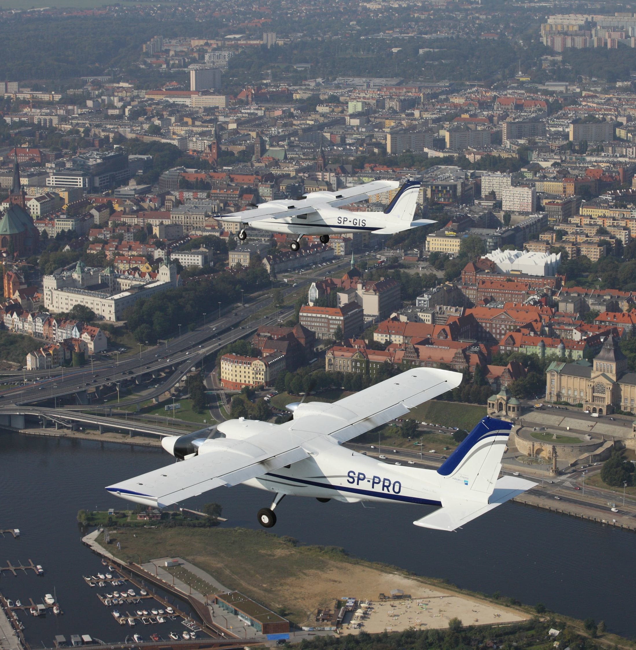
The second project concerned the implementation of an innovative photogrammetric aviation platform. The constructed system is based on a twin-engine airplane adapted to the installation of a large-format photogrammetric camera, an aerial topographic scanner and thermal camera. The implementation of the platform also included the formation of a team responsible for the full range of aerial and photogrammetric works and the launch of a number of security procedures. The effort we made allowed us to significantly increase the services offered. Thanks to these activities, we have become one of the leaders of the photogrammetric market in Poland. We confirm this by participating in projects important for the development of our country, i.e. the development of orthophotos for the needs of LPIS, delivery of high-altitude studies for the construction of the ISOK flood prevention system.
During this period, we expanded our activities to foreign markets. The developed and implemented technologies allowed our engineers to effectively compete with Western companies. Since then, we have successfully completed many orders on foreign markets, including German, Swedish, Czech, Lithuanian, Swiss and even Portuguese.
The next breakthrough period in our activity was the year 2017. Our company, cooperating with scientific units, became involved in research and development projects. The first project was to develop a methodology for inventory of wood resources using high-resolution aerial remote sensing. On the basis of the obtained results, we started research and development works on a prototype technology of a multisensory aeronautical diagnostic station, enabling a large-scale inventory and parameterization of vegetation. The project ended with full success in 2020. Its effects significantly increased the possibilities of our services in the field of photogrammetry, remote sensing and environmental analysis.
Since 2020, we have been carrying out research and development work on the development of a multimodal mapping system for the needs of inland and sea waterways and areas of exploitation. The technology under development is to integrate measurement sensors operating in various environments: aviation, land and underwater, in order to achieve synergy of obtained data. All above-water and underwater elements will be measured simultaneously, and the obtained data will be processed in semi-automatic and automatic processes based on e.g. artificial intelligence.

The increase in the share of research and development projects in the activities of our company prompted us in 2021 to establish the special purpose company GISPRO Technologies Sp. z o.o. Its activities include scientific research and development in the field of natural and technical sciences. Statutory tasks are carried out in close cooperation with Polish and foreign research units.
From the beginning of the establishment of GISPRO, we have been continuously working on the development of our company. We invest in state-of-the-art solutions and develop our own innovative technologies. We make sure that our services meet the highest standards. Currently, we operate in many fields related to broadly understood geoinformation. We provide services in the field of surveying, geomatics, photogrammetry and aerial and ground remote sensing, infrastructure investment services and IT. Our team consists of over 140 employees, mostly expert engineers with unique knowledge and skills.
Our efforts are focused on the further development of our company. We trust that the briefly mentioned story is only a prelude to our further actions, which we will be able to share soon.
Management Board and management of the Company
Łukasz Jedynak
CEO
Małgorzata Cielesz-Studencka
Finance and Accounting Director
Chief accountant
Marta Sieczkiewicz
Director of the Photogrammetry and Remote Sensing Department
CEO of GISPRO Technologies Sp. z o.o.
Research and Development Center
Grzegorz Szalast
Director of Sales and Business Development
Dawid Chodara
Director of the Department of Geomatics and
Terrestrial Remote Sensing
Jacek Czyżyk
Director of the IT Department
Rafał Kowalski
Director of the Department of Geodesy and Cadastre
Karol Czeremcha
Director of the Department of Engineering Geodesy